
Agriculture Aerial Imagery PowerPoint PPT Presentations
All Time
Recommended

How Aerial Imagery Can Track Agricultural Change
| PowerPoint PPT presentation | free to view

Discover the best high resolution aerial imagery of the UK with GetMapping.co.uk. Explore stunning visuals for mapping and analysis purposes.
| PowerPoint PPT presentation | free to download

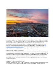
View of San Francisco from a Kite, 1906. USDA-FSA-APFO. Pigeon Camera ... Change over time. Fields and homes, new roads, commercial sites. Time machine. ...
| PowerPoint PPT presentation | free to view

The Farm Service Agency's. National Agricultural. Imagery Program (NAIP) ... Direct Digital 35mm Cameras. Aerial Mapping Cameras (1:40,000 QQC) Satellite Imagery ...
| PowerPoint PPT presentation | free to download

Industry Insights by Type (Vertical, Low Oblique and High Oblique), by Application (Surveillance and Monitoring, Geospatial, Conservation and Research, Construction and Development, Disaster Management, Exhibition and Entertainment, and Energy and Resource Management), by End User (Government, Civil Engineering and Archaeology, Defense, Energy and Mining, Media and Entertainment, Agriculture and Forestry, and Others)
| PowerPoint PPT presentation | free to download

U.S. Geological Survey, 511 National Center, 12201 Sunrise Valley Drive, Reston, VA 20192-0002 ... USGS/USDA developed agreement to funding preliminary ...
| PowerPoint PPT presentation | free to download

Over 10 million film negatives archived at FSA Aerial Photography Field Office (APFO) ... Provide new photography/digital imagery on an annual basis ...
| PowerPoint PPT presentation | free to download

APFO reviews product and distributes to Service Centers and partners ... NAIP Camera Trends. Film Cameras vs. Digital Sensors ...
| PowerPoint PPT presentation | free to download

Direct digital acquisition requires mosaicking of several images ... Test different digital camera footprints. Resolve issues before proceeding to all states ...
| PowerPoint PPT presentation | free to view

Fire & Aviation Mgt. Forest Health Protection - International Programs ... Forest Service funding for fire suppression is based on the current ten-year ...
| PowerPoint PPT presentation | free to download

ESTIMATING WOODY BROWSE ABUNDANCE IN REGENERATING CLEARCUTS USING AERIAL IMAGERY Shawn M. Crimmins, Alison R. Mynsberge, Timothy A. Warner INTRODUCTION Timber harvest ...
| PowerPoint PPT presentation | free to download

Discover the best high resolution aerial imagery of the UK with GetMapping.co.uk. Explore stunning visuals for mapping and analysis purposes.
| PowerPoint PPT presentation | free to download
Discover high-quality aerial photography services in the UK with Getmapping. Our innovative geospatial solutions offer scalable options for mapping, data hosting, online delivery, and web-based GIS. Trust our portfolio of value-added products to meet your specific needs and enhance your projects.
| PowerPoint PPT presentation | free to download

Colour Aerial imagery Perth (combination of Red, Green and Blue) is what we are accustomed to seeing with our own eyes.
| PowerPoint PPT presentation | free to download

Request Sample of Report @ https://bit.ly/2LlV7Bp The Asia Pacific geospatial imagery analytics market is expected to show excellent growth rate between 2019 and 2025, growing at a CAGR of over 25%. In the region, various aerial imaging platforms, such as drones and surveillance cameras, are widely used in agriculture, construction, marine, and defense to gather spatial information, which can be used by GIS professionals to support their decision-making process.
| PowerPoint PPT presentation | free to download

Phase One drone cameras provide invaluable aerial imagery data that enables predictive maintenance for inspection missions of power lines, wind turbines, roads, bridges, and pipelines, as well as agriculture. Our solutions increase the speed and precision of data collection and reduce the costs and risky operations of ground teams.
| PowerPoint PPT presentation | free to download
The worldwide agriculture drone services market size is projected to attain a value of $893.0 million in 2023. Over the subsequent decade, it is anticipated to expand at a robust CAGR of 22.5%, reaching an impressive market worth of $6,795.6 million by 2033.
| PowerPoint PPT presentation | free to download

TBRC global geospatial imagery analytics market report includes agriculture, mining and manufacturing, defense and security, energy, insurance, other applications https://bit.ly/3yGxgTq
| PowerPoint PPT presentation | free to download

The aerial imaging market refers to the use of aerial photography and remote sensing to capture images of the Earth's surface from an elevated position. It utilizes advanced imaging technologies such as digital cameras, LiDAR, and multispectral sensors mounted on aircraft, helicopters, or drones. Aerial imaging finds applications in various industries including agriculture, construction, real estate, and environmental monitoring.
| PowerPoint PPT presentation | free to download

Aerial photography involves creating larger-than-life imagery that leaves a lasting impact on viewers. It’s the image that allows you to make a grand entrance irrespective of the type of industry you are in. Read more - https://videomarketingdubai.medium.com/all-you-need-to-know-about-aerial-photography-25952ff2c816
| PowerPoint PPT presentation | free to download

Market Size – USD 52.87 Billion in 2021, Market Growth – at a CAGR of 5.1%, Market Trends – Increasing integration of Geographic Information System software in agriculture
| PowerPoint PPT presentation | free to download

... Imaging / Prescription Maps In Time Digital Infrared Aerial Imagery Scout Map to Prescription Map in minutes John Deere Agri ... for VRT Engine -driven Hydraulic ...
| PowerPoint PPT presentation | free to view

The growth can be credited to the increasing adoption of light weighted helicopters across various sectors. Helicopters
| PowerPoint PPT presentation | free to download

Course Code GEOG2112 Department of Geography Faculty of Humanities and Social Sciences United Arab Emirates University Dr. M. M. Yagoub E-mail: myagoub@uaeu.ac.ae
| PowerPoint PPT presentation | free to download

The adoption of aerial imaging has increased in various sectors such as agriculture & forestry, energy & resource management, tourism, research, and media & entertainment among others. In addition, adoption of location-based services (LBS) for navigation & remote monitoring is expected to drive the growth of the aerial imaging market.
| PowerPoint PPT presentation | free to download

Shannon Huber Norwood. Multi-County ... 22,000 for third party auto-guidance setup $12,000 for third-party base station ... Some dealers provide network ...
| PowerPoint PPT presentation | free to download
Unmanned Aerial Vehicle(UAV), for Oil Palm Plantation
| PowerPoint PPT presentation | free to download

Whipsmartmi.com describes potential business opportunities in the “Aerial Imaging Market”. The goal of the report is to estimate market, & future development
| PowerPoint PPT presentation | free to download

Global Aerial Imaging market is expected to grow at a CAGR of 14%. The increasing adoption of aerial imagery in multiple application areas, such as surveillance and monitoring, geospatial, energy and resource management, conservation and research, exhibition and live entertainment, disaster management, construction and development has been the key driver for the market.
| PowerPoint PPT presentation | free to download

Aerial imaging market size is estimated to reach over USD 2.5 billion by 2022. Escalating demand from numerous application sectors such as commercial and forestry & agriculture is anticipated to drive the industry growth over the next few years.
| PowerPoint PPT presentation | free to download

The global powered agriculture market size reached USD 52.87 Billion in 2021 and is expected to register a revenue CAGR of 5.1% during the forecast period, according to latest analysis by Emergen Research. Increasing need for cost-effective farming and demand for better quality farming products and equipment are some key factors expected to support market revenue growth between 2022 and 2030.
| PowerPoint PPT presentation | free to download

The global aerial imaging market is projected to reach USD 3.3 billion by 2024. It will grow at an estimated 13.5% CAGR over the forecast phase (2016-2024). Aerial imaging or imagery involves capturing ground images using unmanned aerial vehicles (UAVs), helicopters, dirigibles, blimps, kites, and parachutes.
| PowerPoint PPT presentation | free to download

Read here the latest updates on the " Smart Agriculture Solution Market Analysis " published by CMI team
| PowerPoint PPT presentation | free to view

Thomas Eugene Avery and Graydon Lennis Berlin, Fundamentals of Remote Sensing ... 1969: Neil Armstrong and Buzz Aldrin became the first humans to walk on the Moon. ...
| PowerPoint PPT presentation | free to download

Mapping Olive Plantations Using Sentinel-2 MSI Imagery Case Study: Bashiqa City, Iraq
| PowerPoint PPT presentation | free to download

What crops will be irrigated? ... How much water will they apply to future crops? ... In wet years, they need little more than a supplement to rainfall for most crops. ...
| PowerPoint PPT presentation | free to view

Flint River Basin Water Conservation and Development Plan ... resources lagoons, wetland ponds, cypress swamps, bayou, sink holes, springs ...
| PowerPoint PPT presentation | free to download

The soaring demand for geospatial analytics solutions from business organizations to ensure demographic and geospatial support for their investment plans is driving the market growth.
| PowerPoint PPT presentation | free to download

Request Sample of Report @ https://bit.ly/25dXabt Aerial Imaging Market in UAV/drone segment is expected to hold the majority market share of around 78% by 2024 due to the extensive adoption of the platform for aerial photography applications by the government and defense sectors. As drones offer a convenient imaging alternative for capturing aerial photographs in urban areas, government agencies are increasingly adopting these platforms for law enforcement and crime investigation purposes.
| PowerPoint PPT presentation | free to download

... arms, and neck, the bugs will buzz your eyes, the pollen will make you sneeze. Last night's rain will cause your feet to weigh 10 times their normal amount ...
| PowerPoint PPT presentation | free to view

Repeat cycles of 1 to 5 years depending on location and resolution ... Use for farmstead activities (e.g. routing driveways, and locating new feedlots and buildings) ...
| PowerPoint PPT presentation | free to view

The global Aerial Imaging Market is projected to reach USD 3.3 billion by 2024. It will grow at an estimated 13.5% CAGR over the forecast phase (2016-2024).
| PowerPoint PPT presentation | free to download

Precision Agriculture involves the application of data acquisition/control ... GIS Example: Mapquest.com. From phone book: 421 S. Geneva St. Ithaca, NY ...
| PowerPoint PPT presentation | free to view

Operational fully automated preliminary classification of multispectral satellite imagery
| PowerPoint PPT presentation | free to view

Aerial imaging is the process of capturing images of ground surfaces with the help of cameras attached to vehicles, such as helicopters, parachutes, aircraft, kites, unmanned aerial vehicles (UAVs), balloons, vehicle-mounted poles, and airships. Aerial imaging helps in risk mitigation, resource planning, mapping, research and excavation, security and surveillance, urban planning, engineering, farming management, tourism, and others.
| PowerPoint PPT presentation | free to download

The global aerial imaging market is projected to reach USD 3.3 billion by 2024. It will grow at an estimated 13.5% CAGR over the forecast phase (2016-2024).
| PowerPoint PPT presentation | free to download

Integration of satelliteaerial images and GPS for field work
| PowerPoint PPT presentation | free to download

Graphical Research has reported the addition of the “Aerial Imaging Market: Europe Industry Analysis and Opportunity Assessment 2019 - 2024" report to their offering.
| PowerPoint PPT presentation | free to download

Remote Sensing in Agriculture and Aquaculture. Determination of a quantity ... during a flight and sends corrective signals to the aileron and elevator servos. ...
| PowerPoint PPT presentation | free to view

Growing demand in emerging application areas including natural resources management, energy, and disaster prevention is expected to drive the market over the next six years.
| PowerPoint PPT presentation | free to download

5 Years of Teaching Precision Agriculture at a California Community College West Hills Community College Farm of the Future Overview West Hills College Coalinga ...
| PowerPoint PPT presentation | free to view

Ground-based sensors are typically used for ground truth measurements. ... Spray Treatment Setup. Spray Mixture. All treatments were made with Helosate PlusTM ...
| PowerPoint PPT presentation | free to view

Many projects working on digital libraries, or on-line data archives, including ... of earth observation system (EOS) data from satellites and aerial photography. ...
| PowerPoint PPT presentation | free to view

As part of the code of practice for aerial application, NZCPA was contracted by ... GALILEO is Europe's answer to the American and Russian systems and is set to ...
| PowerPoint PPT presentation | free to view

ITS A SEMINAR PRESENTATION WHICH I HAD TO PRESENT DURING A NATIONAL CONFERENCE AND IT FETCHED ME THE BEST ORAL PRESENATATION AWARD
| PowerPoint PPT presentation | free to download

USDA FSA-APFO Storage provisioning within a Geospatial Data Warehouse USDA Imagery Planning and Coordination December 5, 2006 David A. Nabity Aerial Photography ...
| PowerPoint PPT presentation | free to download