
Aerial Imagery PowerPoint PPT Presentations
All Time
Recommended

Discover the best high resolution aerial imagery of the UK with GetMapping.co.uk. Explore stunning visuals for mapping and analysis purposes.
| PowerPoint PPT presentation | free to download

View of San Francisco from a Kite, 1906. USDA-FSA-APFO. Pigeon Camera ... Change over time. Fields and homes, new roads, commercial sites. Time machine. ...
| PowerPoint PPT presentation | free to view

How Aerial Imagery Can Track Agricultural Change
| PowerPoint PPT presentation | free to view

Background from: Earth And Moon Viewer. http://www.fourmilab.ch/earthview/vplanet.html. The Earth ... Background From: Earth As Art. http://landsat.gsfc.nasa. ...
| PowerPoint PPT presentation | free to view

Industry Insights by Type (Vertical, Low Oblique and High Oblique), by Application (Surveillance and Monitoring, Geospatial, Conservation and Research, Construction and Development, Disaster Management, Exhibition and Entertainment, and Energy and Resource Management), by End User (Government, Civil Engineering and Archaeology, Defense, Energy and Mining, Media and Entertainment, Agriculture and Forestry, and Others)
| PowerPoint PPT presentation | free to download

Fire & Aviation Mgt. Forest Health Protection - International Programs ... Forest Service funding for fire suppression is based on the current ten-year ...
| PowerPoint PPT presentation | free to download

ESTIMATING WOODY BROWSE ABUNDANCE IN REGENERATING CLEARCUTS USING AERIAL IMAGERY Shawn M. Crimmins, Alison R. Mynsberge, Timothy A. Warner INTRODUCTION Timber harvest ...
| PowerPoint PPT presentation | free to download

Aerial imagery provides enriched point of vision that further provides amplified vision of larger areas from distant angles that enables witnessing of surface of the earth in an authenticated manner. The global aerial imagery market is anticipated to reach USD 5.2 billion by 2024, at a CAGR of 14.5% during 2018-2024. The capability of aerial imagery in order to provide improved and sudden view of any surface specifically in construction activities for instance for the development of water based and thermal project is expected to bolster the demand for aerial imagery market across the globe. Ability of this technology to enable the business organizations in monitoring and recording surface of the earth that ultimately helps in freezing time and advancing imaging resolutions is ultimately creating huge momentum for the growth of the market.
| PowerPoint PPT presentation | free to download

One Tree Hill. Three Kings. Mt. Albert. Mt. Roskill. Mt. St. John. Te ... One Tree Hill erupted about 20,000 years. ago. It stands 183 meters high. Red arrows ...
| PowerPoint PPT presentation | free to view

Discover the best high resolution aerial imagery of the UK with GetMapping.co.uk. Explore stunning visuals for mapping and analysis purposes.
| PowerPoint PPT presentation | free to download
Discover high-quality aerial photography services in the UK with Getmapping. Our innovative geospatial solutions offer scalable options for mapping, data hosting, online delivery, and web-based GIS. Trust our portfolio of value-added products to meet your specific needs and enhance your projects.
| PowerPoint PPT presentation | free to download

Colour Aerial imagery Perth (combination of Red, Green and Blue) is what we are accustomed to seeing with our own eyes.
| PowerPoint PPT presentation | free to download

If you looking for drone aerial surveys in the UK. Check out our drone aerial surveys! We provide high-quality drone surveys for photography, promotional videography, house surveys, etc. Get in touch for a free consultation and contact us today at 01283 542257
| PowerPoint PPT presentation | free to download

... of Department of Defense (DoD), national, and ... DCD, Air Defense Artillery School. DCD, Armor School. DCD, Aviation School. DCD, Engineer School ...
| PowerPoint PPT presentation | free to view
Unmanned Aerial Vehicles (UAV s) Unmanned Underwater Vehicles (UUV s) and Swarms Joseph T. Wunderlich, Ph.D. Unmanned Aerial Vehicles (UAV s) Unmanned Aerial ...
| PowerPoint PPT presentation | free to download
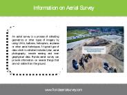
We offer licensed surveys include 3D tampa mapping, aggregate & stockpile volume measurement in Miami, East & West Coast at Florida Aerial Survey Technologies
| PowerPoint PPT presentation | free to download

Tax Administrators use aerial imagery for property mapping. Results ... Temporal Analysis. North Carolina State University Libraries ...
| PowerPoint PPT presentation | free to view

Explore the vast collection of Indshine’s ariel maps. Indshine offers access to updated ariel maps to reduce field inspections with a better resolution than satellite maps. Indshine is one of the recognized ariel maps services provider that offers orthographic ariel maps across numerous industries.
| PowerPoint PPT presentation | free to download

By using High Exposure’s high-resolution footage to create aerial visual content for your online advertisements, you can instantly differentiate your agency from the competition.For more details please visit at https://www.highexposure.com.au/aerial-photography-for-real-estate/
| PowerPoint PPT presentation | free to download
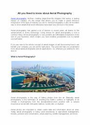
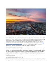
Aerial photography involves creating larger-than-life imagery that leaves a lasting impact on viewers. It’s the image that allows you to make a grand entrance irrespective of the type of industry you are in. Read more - https://videomarketingdubai.medium.com/all-you-need-to-know-about-aerial-photography-25952ff2c816
| PowerPoint PPT presentation | free to download
... of Nevada Aerial Photo Efficiency. Rangeland Estimation ... Inspection Prints. Digital Spot Index. Imagery scanned @ one foot GSD. One ortho-rectified, MrSID ...
| PowerPoint PPT presentation | free to download

The growth can be credited to the increasing adoption of light weighted helicopters across various sectors. Helicopters
| PowerPoint PPT presentation | free to download

... Imaging / Prescription Maps In Time Digital Infrared Aerial Imagery Scout Map to Prescription Map in minutes John Deere Agri ... for VRT Engine -driven Hydraulic ...
| PowerPoint PPT presentation | free to view

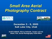
The Farm Service Agency's. National Agricultural. Imagery Program (NAIP) ... Direct Digital 35mm Cameras. Aerial Mapping Cameras (1:40,000 QQC) Satellite Imagery ...
| PowerPoint PPT presentation | free to download
Course Code GEOG2112 Department of Geography Faculty of Humanities and Social Sciences United Arab Emirates University Dr. M. M. Yagoub E-mail: myagoub@uaeu.ac.ae
| PowerPoint PPT presentation | free to download

Over 10 million film negatives archived at FSA Aerial Photography Field Office (APFO) ... Provide new photography/digital imagery on an annual basis ...
| PowerPoint PPT presentation | free to download
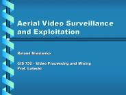
Aerial Video Surveillance and Exploitation Roland Miezianko CIS 750 - Video Processing and Mining Prof. Latecki Agenda Aerial Surveillance Comparisons Technical ...
| PowerPoint PPT presentation | free to download
Unmanned Aerial Vehicle(UAV), for Oil Palm Plantation
| PowerPoint PPT presentation | free to download

Whipsmartmi.com describes potential business opportunities in the “Aerial Imaging Market”. The goal of the report is to estimate market, & future development
| PowerPoint PPT presentation | free to download

Falcon 3D is one of the leading survey engineering companies in UAE. To track, map, survey, inspect, and manage your worksite projects, contact the Falcon 3D experts today.
| PowerPoint PPT presentation | free to download

Request Sample of Report @ https://bit.ly/2LlV7Bp The Asia Pacific geospatial imagery analytics market is expected to show excellent growth rate between 2019 and 2025, growing at a CAGR of over 25%. In the region, various aerial imaging platforms, such as drones and surveillance cameras, are widely used in agriculture, construction, marine, and defense to gather spatial information, which can be used by GIS professionals to support their decision-making process.
| PowerPoint PPT presentation | free to download

Comparing results of classification of images into land cover categories with reality ('truth' ... E.g., if evaluating satellite-derived imagery, may use aerial photos ...
| PowerPoint PPT presentation | free to view

We are innovative UAV services providers specializing in conducting aerial inspections by utilizing advanced technology & systems.
| PowerPoint PPT presentation | free to download

ASPRS Imagery Users Workshop
| PowerPoint PPT presentation | free to view

Aerial Targets and RPAs Way Ahead 41st Annual NDIA Targets, UAVs
| PowerPoint PPT presentation | free to view

Global Aerial Imaging market is expected to grow at a CAGR of 14%. The increasing adoption of aerial imagery in multiple application areas, such as surveillance and monitoring, geospatial, energy and resource management, conservation and research, exhibition and live entertainment, disaster management, construction and development has been the key driver for the market.
| PowerPoint PPT presentation | free to download

Unmanned Aerial Vehicles New Frontiers
| PowerPoint PPT presentation | free to view
, the Unmanned Aerial Vehicle market was dominated by General Atomics (US), Northrop Grumman Corporation (US), Boeing (US),and DJI (China).
| PowerPoint PPT presentation | free to download
Aerial Video Surveillance and Exploitation ... 2 Camera must scan the region of interest to get the full-picture Objects of interest move in and out of ...
| PowerPoint PPT presentation | free to download

We give you the sky advantage Our goal at Yapstar is to provide excellence in elevated imagery, video and other UAV services in Jamaica. Our talented team.
| PowerPoint PPT presentation | free to download

Mapping Olive Plantations Using Sentinel-2 MSI Imagery Case Study: Bashiqa City, Iraq
| PowerPoint PPT presentation | free to download

DHS Unmanned Aerial Vehicle Brief
| PowerPoint PPT presentation | free to view

The global aerial imaging market is projected to reach USD 3.3 billion by 2024. It will grow at an estimated 13.5% CAGR over the forecast phase (2016-2024). Aerial imaging or imagery involves capturing ground images using unmanned aerial vehicles (UAVs), helicopters, dirigibles, blimps, kites, and parachutes.
| PowerPoint PPT presentation | free to download

Thomas Eugene Avery and Graydon Lennis Berlin, Fundamentals of Remote Sensing ... 1969: Neil Armstrong and Buzz Aldrin became the first humans to walk on the Moon. ...
| PowerPoint PPT presentation | free to download

Aerial triangulation is the next step in the rectified image production process. ... Seam lines (between tiles and mosaic lines within tiles) are well hidden ...
| PowerPoint PPT presentation | free to view
Create unique aerial perspectives in your property listing’s to showcase the exterior and surrounding location. Our professional drone hire services are ready to create a promotional package to suit your needs. Get full details at http://www.highexposure.com.au
| PowerPoint PPT presentation | free to download

The aerial imaging market refers to the use of aerial photography and remote sensing to capture images of the Earth's surface from an elevated position. It utilizes advanced imaging technologies such as digital cameras, LiDAR, and multispectral sensors mounted on aircraft, helicopters, or drones. Aerial imaging finds applications in various industries including agriculture, construction, real estate, and environmental monitoring.
| PowerPoint PPT presentation | free to download

4th Annual Association of Unmanned Vehicle Systems International Student ... Engine: 1.6 bhp Tower Hobbies .61. UK Aerial Robotics Team. University of Kentucky ...
| PowerPoint PPT presentation | free to view

Spatially Accurate Aerial Oblique Views
| PowerPoint PPT presentation | free to view

TBRC global geospatial imagery analytics market report includes agriculture, mining and manufacturing, defense and security, energy, insurance, other applications https://bit.ly/3yGxgTq
| PowerPoint PPT presentation | free to download

Hi-resolution still images. Examined by human or machine. Video captures dynamic events ... Video uses telephoto lens to get high resolution to identify objects ...
| PowerPoint PPT presentation | free to download
Aerial video in Los Angeles captures eye-catching images that are vivid and unique. Log on http://www.wildrabbitaerial.com/
| PowerPoint PPT presentation | free to download

BIRDIE: Biologically-Inspired low Reynolds number Dynamic Imagery Experiment Preliminary Design Review Jeff Baxter Jeff Silverthorn Matt Snelling Courtney Terrell
| PowerPoint PPT presentation | free to view

The soaring demand for geospatial analytics solutions from business organizations to ensure demographic and geospatial support for their investment plans is driving the market growth.
| PowerPoint PPT presentation | free to download

Aerial photography is one of the earliest forms of remote sensing. Here are five industries that can utilize a remote control drone to capture quality shots of their product or service. Visit our site to know more about Aerial photography - https://studio52.tv/photography/aerial
| PowerPoint PPT presentation | free to download

When it comes to the top aerial video service in Los Angeles, companies like Wild Rabbit Aerial offer a range of the most important capabilities that make drone cinematography so innovative! Source: http://www.wildrabbitaerial.com/, Information shared above is the personal opinion of the author and not affiliated with the website.
| PowerPoint PPT presentation | free to download