
Geographic PowerPoint PPT Presentations
All Time
Recommended

Geographic reference analysis for geographic document querying. F.Bilhaut , T. ... 'the south of a Bordeaux-Gen ve line' Relevance degree (1) Quantification ...
| PowerPoint PPT presentation | free to view

Geographic Visualization
| PowerPoint PPT presentation | free to download

Title: National Geographic .. Author: Cindy Last modified by: pps-humour.com Created Date: 9/13/2004 10:34:50 PM Document presentation format
| PowerPoint PPT presentation | free to download

Geographic Terms Geographic terms help us describe landforms and bodies of water. Here is a list of the geographic terms that we will learn! How many do you know ...
| PowerPoint PPT presentation | free to view

Title: NATIONAL GEOGRAPHIC II Author: ling Last modified by: user Created Date: 6/10/2005 11:13:57 AM Document presentation format:
| PowerPoint PPT presentation | free to view

Geographic Location & Time Lab 1 Concepts The Earth s Grid Latitude/parallels Longitude/meridians Prime Meridian, Equator Great and small circles Time and Time ...
| PowerPoint PPT presentation | free to download
Geographic Information System (GIS) mapping and surveying is the use of GIS technology to collect, manage, analyze, and visualize spatial data. This data can be used to create maps, charts, and other visualizations that can help people understand and make decisions about the world around them.
| PowerPoint PPT presentation | free to download
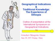
Outline of presentation at the International Symposium on Geographical Indications ... Distinct flavor and aroma. Can be distinguished from coffee of other countries ...
| PowerPoint PPT presentation | free to download

Geographic Patterns
| PowerPoint PPT presentation | free to view

Geographic Profiling Developed by Kim Rossmo as his Ph.D dissertation at Simon Fraser based up the work of the Brantinghams Based on the assumption that crime ...
| PowerPoint PPT presentation | free to download

Geographical Indicators Daniel Pick Economic Research Service What is Champagne? Champagne, a sparkling wine, comes from the Champagne region of France.
| PowerPoint PPT presentation | free to download

Geographical Profiling
| PowerPoint PPT presentation | free to view

Geographic Information Systems GIS Geography Matters (source gis.com and ESRI) Think about Geography What is Geography The 3 W s of ...
| PowerPoint PPT presentation | free to view

Geographic Information Systems GIS Analysis and Modeling 1. Geographic Analysis Geographic questions: where, when, why, and how The purpose of the analysis is to ...
| PowerPoint PPT presentation | free to download

Geographic Information Systems ... Toxic Plume Combining Various Display Methods Oil Spill and Contamination GIS on the Internet Olympics http ...
| PowerPoint PPT presentation | free to download

Title: a National Geographic Author: Csondy Last modified by: Eric Cuypers Created Date: 8/6/2006 11:22:34 AM Document presentation format: Affichage l' cran
| PowerPoint PPT presentation | free to download

The Geographic Index is a tool to measure the variation in cost and services ... An index value is calculated for each expense category ...
| PowerPoint PPT presentation | free to view

Geographic Opportunities Geographic Opportunities Route Development Database Management Tools Utilize Technology Competitor Profiling Outsourcing Product/Brochure ...
| PowerPoint PPT presentation | free to view

WORLD GEOGRAPHY. SEVENTH GRADE. CYNTHIA GODWIN ... VOLCANO. MAP TAP 2003/2004. GEOGRAPHIC TERMS. 15. CAN YOU NAME IT? MAP TAP 2003/2004 ...
| PowerPoint PPT presentation | free to view
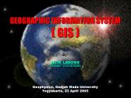
GEOGRAPHIC INFORMATION SYSTEM ( GIS ) By: LILIK LASONO KAGAMA / 11.01.10.93806 Geophysics, Gadjah Mada University Yogyakarta, 23 April 2005 GEOGRAPHIC INFORMATION ...
| PowerPoint PPT presentation | free to download

MicroStation GeoGraphics. Create, store and analyze spatially referenced data ... Data in GeoGraphics is stored in projects. Project includes: ...
| PowerPoint PPT presentation | free to view

Geographic Tongue http://www.drgreene.com/21_784.html http://www.nlm.nih.gov/medlineplus/ency/article/001049.htm Geographic tongue: Glossitis areata exfolviativa - a ...
| PowerPoint PPT presentation | free to view
Geographic Records Management http://www.fbi.gov/ucr/nibrs/manuals/handbook.pdf http://www.cops.usdoj.gov/mime/open.pdf?Item=515 Geographic Filing Alphabetically ...
| PowerPoint PPT presentation | free to download

Geographical Data Mining
| PowerPoint PPT presentation | free to download
Geographical information systems (GIS) . . -
| PowerPoint PPT presentation | free to download

Geographic Information Systems (GIS) An Introduction
| PowerPoint PPT presentation | free to view

The Geographic Cycle WM Davis William Morris Davis Born February 12, 1850, Philadelphia, PA -Graduated from Harvard 1869 -Instructor of geology at Harvard, 1879 ...
| PowerPoint PPT presentation | free to download

global Geographic Information System Market is estimated to surpass $10.21 billion marks by 2026 growing at an estimated CAGR of more than 16.5% during the forecast period 2021 to 2026.
| PowerPoint PPT presentation | free to download

Geographic Searching. Lecture 13. Daniel D. Stuhlman. Libr 244. Eratosthenes ... One source of information is the National Geographic Society's web site. ...
| PowerPoint PPT presentation | free to view
Geographic Information System Geog 258: Maps and GIS February 17, 2006 Outlines What is GIS? What can GIS do? GIS applications Components of GIS What is special about ...
| PowerPoint PPT presentation | free to download

History of Geographic Thought The Spatial Organization of Human Activity Geography is a spatial science (the study of place/space) Human activities are: located ...
| PowerPoint PPT presentation | free to download

Geographic Information System Market Sales, Trend, Region Forecast and Manufacturers in 2030
| PowerPoint PPT presentation | free to download

Title-name coined by Eratosthenes in Greece, ca. 250 B.C.. -Strabo (64 B.C.- A.D.20), early Greek geographer -During Roman days, Chinese geographers knew as much as ...
| PowerPoint PPT presentation | free to view

Describe the five geographic regions of Georgia; include the Blue Ridge Mountains, Valley and Ridge, Appalachian Plateau, Piedmont, and Coastal Plain.
| PowerPoint PPT presentation | free to view
GEOGRAPHIC UNDERSTANDINGS OF AFRICA SS7G1 The student will locate selected features of Africa. Regional Political-Physical Map of Africa Population Map of Africa ...
| PowerPoint PPT presentation | free to download
Module 7: Geographical Charts This module includes information on rate maps and spot maps, the two most common types of geographical charts used in public health.
| PowerPoint PPT presentation | free to download

GIS Geographic Information System Cluster 1 CPAS What is GIS? Geographic Information System (GIS) is a system of computer hardware, software, and procedures designed ...
| PowerPoint PPT presentation | free to download
Muriwai Coastal Geographic Environment A Study of Natural Processes Muriwai INTRODUCTION We define the Muriwai Coastal Geographic Environment as being south from the ...
| PowerPoint PPT presentation | free to download

Overview of Geographic Atrophy (GA) Market Report Helps In Providing Scope and Definitions, Key Findings, Growth Drivers, and Various Dynamics.
| PowerPoint PPT presentation | free to download

Find Local Stores/ Distributors/ Offices / Salesmen by entering a 5 digit zip code. Results are displayed all from a database based on geographic proximity ...
| PowerPoint PPT presentation | free to download

Geographic Information Systems in PA. Mike Spiess 'A map is the greatest of all epic poems. Its lines ... Universal Transverse Mercator (UTM) Mapping Precision ...
| PowerPoint PPT presentation | free to view

Geographic Regions of Georgia SS8G1 The student will describe Georgia with regard to physical features and location. b. Describe the five geographic regions of ...
| PowerPoint PPT presentation | free to download

religious origins: a geographic introduction
| PowerPoint PPT presentation | free to view

Spatial and Geographic Databases Database extensions Database management research is continuously expanding its scope of applicability Problems encountered: What is ...
| PowerPoint PPT presentation | free to download

Geographic Information Systems Data Analysis ...
| PowerPoint PPT presentation | free to view

Dagestan. Geographical Position and Population. Mikhail Nokhov, Gymnasium # 1, Khasavyurt
| PowerPoint PPT presentation | free to download

Geographic Information Systems (GIS) Connecting People with the World Around Them An Information System Remember those overlay maps of the human body from grade ...
| PowerPoint PPT presentation | free to download

The Meaning of Geographic Expressions Dr Kristin Stock kristin.stock@nottingham.ac.uk Q. These houses look like: Comfortable homes A retirement village A slum Mansions Q.
| PowerPoint PPT presentation | free to download

Geographic Regions of Georgia SS8G1 The student will describe Georgia with regard to physical features and location. b. Describe the five geographic regions of ...
| PowerPoint PPT presentation | free to view

Geographical indications (GIs) for wines/ spirits are protected under s. 11 and ... 2. GI advertised by publication in Canada Gazette by Minister of Industry. ...
| PowerPoint PPT presentation | free to view
Geographic Informatics in Health Maged N Kamel Boulos PhD, MSc, MBBCh School for Health, University of Bath Bath BA2 7AY, UK E-mail: M.N.K.Boulos@bath.ac.uk
| PowerPoint PPT presentation | free to download

Louisiana: A Geographic Interpretation Martha L. Henderson, Ph.D. May 1, 2006 Louisiana An Outsider s Perspective Where is Louisiana on the American landscape?
| PowerPoint PPT presentation | free to download

The National Geographic Travel Photo Contest inspires lush and evocative images from around the globe
| PowerPoint PPT presentation | free to download

Pronunciation. Links to other documents/files. And: see next page. 9/7/09 ... Pronunciation guides. phonetic alphabet. 9/7/09. 8th UN Conf Stand Geographical Names ...
| PowerPoint PPT presentation | free to download

Geographic Information Retrieval (GIR) Ranking Methods for Digital Libraries Shorefactor = 1 abs(fraction of query region approximation that is onshore
| PowerPoint PPT presentation | free to download

The process of converting data from paper maps into computer files is ... types of geographic operation the end result is best visualised as a map or graph. ...
| PowerPoint PPT presentation | free to view